

Scurry County receives more than two inches of rain, but dodges tornado threat
-
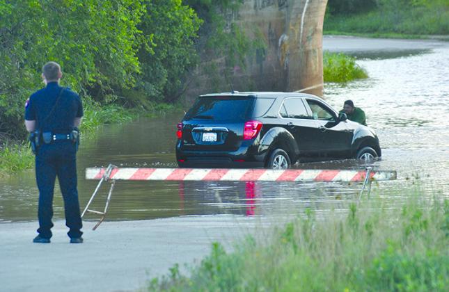 Workers attempt to extricate a vehicle that was stranded in high water on Ennis Creek Road just off of Coliseum Drive this morning.
 -
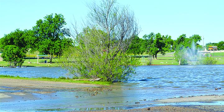 The pond at Towle Park overflowed its banks this morning.
There was a lot of sound and fury — not to mention rain — but fortunately little in the way of damage when thunderstorms pelted Snyder and Scurry County late Monday and early today.
What had been predicted as one of the most significant weather events in more than 10 years produced high winds, more than two inches of rain accompanied by thunder and lightning and reports of tennis ball-sized hail in Hermleigh, but tornadoes spawned by the storm system avoided Scurry County while touching down elsewhere in West Texas.
The biggest danger residents faced was flash flooding caused by heavy rains which quickly inundated low-lying areas and underpasses around the county, but no injuries were reported.
At least two reports of stranded vehicles were reported, one in the Towle Park Pond and the other on Ennis Creek Road just off of Coliseum Drive.
“We were extremely lucky,” Snyder Fire Department Deputy Fire Marshal Nathan Hines said. “The storms didn’t produce any tornadoes until after they had left Scurry County.”
Tornado sightings were confirmed in Howard and Midland counties.
While Scurry County avoided the threat of tornadoes, this area did receive more rain than any almost any other area in the West Texas Mesonet reporting region. More than 2.4 inches of precipitation was recorded at the SnTx Industrial Park, while 2.28 inches of rain was reported at Western Texas College.
Around West Texas, Rotan received 2.71 inches of rain, Colorado City recorded 1.43 inches, Sweetwater tallied a little more than a half-inch of rain, Gail received 0.72 inches of rain and Fluvanna recorded 0.46 of an inch of precipitation. The highest rainfall reading in the Mesonet region was at Weinert, which recorded 4.35 inches of precipitation.
Hail accompanied Monday night’s storm, but did not account for any extensive damage. Hermleigh reported hail ranging in size from a quarter to a tennis ball, but most hail reports in Snyder were in the pea-sized range.
High winds accompanying the storm system peaked at 52 mph at 11:15 p.m. Monday and consistent gusts of between 30-36 mph were reported throughout Monday afternoon.
At times, visibility on sections of U.S. Hwy. 84 south of Snyder was nearly zero as the winds blew dirt and sand.
There were few power outages blamed on Monday’s storm. Oncor reported at 9:15 a.m. today that 20 customers in the Snyder area were without electricity. Power was expected to be restored by mid-day.
The National Weather Service is forecasting sunny skies and warm temperatures today and Wednesday before a chance of more rain returns Wednesday night and continues through Saturday.